

Getting across the water.
Getting across the water.
Bridges in Yunnan
Introduction
The many rivers and mountain ranges in Yunnan have always added to the isolation of the province.
To overcome this many bridges have been constructed to cross the often wild rivers that could not safely be crossed by boat. Some of these historic bridges are still standing.
The oldest bridges were in the trade route from central China to India known as the "Southern Silk Road". Other bridges were constructed to facilitate the salt trade. Others, like the bridges at Jianshui were more to show off the wealth of the people in power.
The construction of the "Burma Road" required the replacement of footbridges by larger constructions that could carry fully loaded trucks. These bridges later on were the scenes of many battles during the Japanese infiltration into Western Yunnan from Burma.
The construction of the Yunnan–Vietnam Railway brought modern railway bridge designs to Yunnan and some spectacular bridges. Not depicted here are the many modern, often spectacular, highway bridges aiding the new motorways through the mountains and across the valleys.

In the Yunlong district (North-West of Dali) there are several ancient bridges spanning the Pi river. See our special page on the Pi River Bridges.
Crossing the Lapu river (a contributory stream to the Yangtze) in the Northwest of Yunnan, are some, lovingly maintained, roof covered wooden bridges.
Across the Longchuan river north of Tengchong there are several wooden bridges like the Chengde and Tongji bridge and the old suspension bridge at Yong'an.
The Jihong Bridge was the place where all trails of the Southern Silk-road came together in order to cross the mighty Lanciangliang (Mekong).
The Huitong Bridge across the Nujiang (Salween) and the Gongguo Bridges across the Lancangjiang (Mekong) where the vital bridges on the Burma road.
The upper Nujiang valley has a lot of interesting bridges that are the only connection between the two sides of the river.
Qingyun Bridge
The Qingyun Bridge, just outside Yunlong across the Pi River is one of the many ancient bridges spanning this river. The bridge was an important link in salt trade.
For more on these bridges see our page on the Pi River Valley.


Longchuan river bridges
The Longchuan river bridges North of Tengchong in Western Yunnan come in different forms and shapes. Some look like a heap of old planks spanning a river while others are lovingly maintained. The wooden Chengde and Tongji bridges were reconstructed in 1946, their much older predecessors were damaged on purpose during WW-II.
It is a pity that the historic value of these bridges is at the moment hardly appreciated and many are poorly or not at all maintained and fade away like the old Yong'an rope bridge.


Grand Kanglang Bridge
The Grand Kangland Bridge is crossing the Niujie stream.
The bridge has recently been renovated also the eastern access to the bridge has been blocked by a landslide.
Renovation in Yunnan often is done in such a way that the original character is completely destroyed.
This impressive bridge is located in the middle of nowhere.


Nujiang bridges
The Nujiang river, in the west better known as the Salween, is the most western river coming down from Tibet in China.
In the narrow upper Nujiang valley (Salween) there is only one road and bridges are needed to make it to the other side of the valley.


Huitong Bridge
This "Burma Road" bridge (Sometimes spelled as Hwei Tung), with a span of 123 metres, has been preserved as a monument because it was here that the Japanese army was stopped during World war-II. The invaders coming up the Burma road from the southwest were unable to cross the Nujiang river (Salween) after the bridge was blown up on the 5th of May 1942 by the Chinese defence.
The bridge was reconstructed to handle the supplies coming up the Ledo road after the Chinese recaptured Songshan mountian and the far Western part of Yunnan again at the end of 1944. The present form dates from 1950 and carries the communist star on the rebuild Eastern bridgehead.


Huiren Bridge
The Huiren Bridge spanning the Nujiang was built in 1839 as part of the Southern Silk road connecting Baoshan and Tengchong. It was a double span chain bridge with spans of 78 and 52 metres. With six bottom chains the bridge was 2.6 metres wide but lacked the strength to carry vehicles. The bridge towers are built in the then popular European style.

The Bridge got destroyed in 1942 in defence of Yunnan when the Japanese army occupied the west bank. The bridge was replaced by a modern bridge more downstream in 1947.
Also the actual bridge itself is missing the remains are still impressive with its massive central tower and the eastern bridge head rising high above the water.


Shuanghong Bridge
The translation for Shuanghong is double rainbow. The Shuanghong bridge is a double span iron chain bridge.

The Bridge was first built in 1759 and renewed in 1923. The eastern span is 67 metres long and has 15 chains. The western span is 38 metres long and has 12 chains. For a long time it was the only bridge spanning the upper Nujiang but is now only used by local farmers. The west side has a steep cobble stone access path while the east bank only has a dirt track leading from the bridge.


The roof of the western bridgehead and guard tower has largely collapsed and plants are growing all over it (Photo above).
At the middle pier the iron chains are exposed for both spans (Photo left) (Photo two up).
The pavilion that once stood on the middle pier was struck by lightning and has burned down.

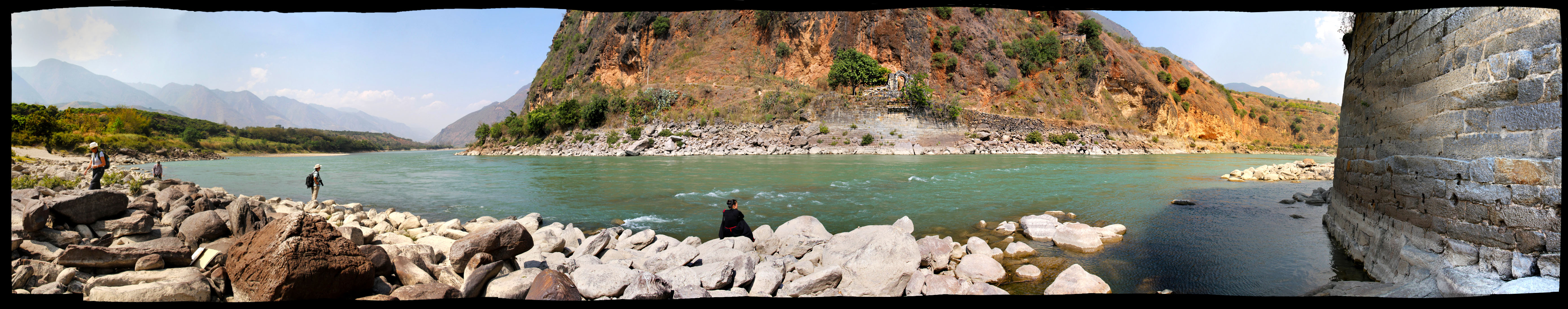
Lancangjiang bridges
The Lancangjiang, in the west better known as the Mekong is a formidable river with only a few bridges crossing it.
The Lancangjiang is dammed several times over its length in Yunnan and now flows through many reservoirs used for hydroelectricity. These dams caused the loss of several historic bridges like the for the Burma Road essential Gongguo Bridge and the ancient Southern Silk road Jihong Bridge and the crucial tea horse trail Qinglong Bridge. Only when the reservoirs are empty the remnants of these bridges can be seen.

Jihong Bridge
The Jihong Bridge was the oldest bridge spanning the Lancangjiang (Mekong). The bridge known formally as the Lanjin Bridge was a vital link in the Southern Silk Road and the only place where the river could be crossed by bridge.
The last Jihong Bridge was washed away by floods in 1986 and the bridge was never rebuild. The bridge heads and the stone carvings on the cliff overlooking it have disappeared under the water of the reservoir now build in this part of the river. Those following the Southern Silk Road till recently had to be ferried across by rowing boat. Now there is a new suspension bridge build to aid the construction work on two bridges one for the new railway to the west of Yunnan province, the other for the crude oil and natural gas pipelines.


Gongguo Bridges
As part of the "Burma road" the Gongguo bridges spanned the Lancangjiang (Mekong).
The "Old" Gongguo Bridge had been upgraded in 1938 in order to handle the supplies that came up the Burma road. This bridge was still too small and goods had to be hand carried across. Small trucks could then take the bridge while empty and big trucks had to take a ferry across the river.
In November 1940 the "New" Gongguo Bridge, with a span of 90 meters, was completed some 800 metres upstream in order to improve the capacity of the Burma Road to 10 tons.
Both bridges were bombed several times from the air because they played a vital role in the supply of the Chinese troops stopping the Japanese invaders at the Nujiang river (Salween).

Both bridges have now disappeared in the reservoir that now forms the junction of the Lancangjiang and Pi River.
One bridgehead of the "Old" Gongguo Bridge has been moved uphill and is now part of a monument commemorating the history of these bridges and the vital role they played in the war against Japan and the defence of western Yunnan. Strangely the location of these two bridges is not displayed in the model of the river that forms part of the monument.


Yunlong Bridge
The Yunlong iron chain bridge in Yangbi was part of the Southern Silk Road named the Bonan trail after the Bonan mountain on its way to the Jihong Bridge across the Lancanjiang.
The 39 meters long bridge was rebuild several times. The origins of the present form date back to 1692.
Note the ancient mosque in the background. Muslim Bai-Hui traders were frequent users of the old roads and ancient bridges.


Pudu Bridge
The Pudu Bridge is a rare combination of a wooden covered bridge and an iron chain bridge.
The 36 meters long bridge was reconstructed in 1928.
In April 1936 the bridge was captured, after heavy fighting, by the Red Army faction that moved up north through this remote part of Yunnan on their Long March.
Next to the bridge is a cemetery for the Red Army soldiers that lost their life in the battle.


Xingxiu Bridge
The seven arch and 118 metres long Xingxiu Bridge in Lufeng is part of the ancient salt trade route. The present day bridge dates from 1832 replacing the bridge from 1612.


Shuanglong Bridge
The Shuanglong Bridge like the Xingxiu Bridge above is a show-off bridge accross an artificial lake.
The present form dates from 1898. The bridge was renovated in 2015.
The bridge is located in the Jianhshui valley but nor connected to any large population area. There are several other show-off bridges along the same river.


Bamboo Bridges
There are still several bridges made of bamboo or made with bamboo.


Qingyun Bridge.
Location: 25°52'54" N. 99°22'04" E.
Altitude: 1635 meters / 5364 feet.
Chengde Bridge.
Location: 25°17'50" N. 98°36'23" E.
Altitude: 1480 meters / 4856 feet.
Tongji Bridge.
Location: 25°24'39" N. 98°37'57" E.
Altitude: 1519 meters / 4984 feet.
Yong'an Bridges.
Location: 25°19'32" N. 98°36'23" E.
Altitude: 1482 meters / 4862 feet.
Grand Kanglang Bridge.
Location: 24°58'03" N. 100°42'20" E.
Altitude: 1378 meters / 4521 feet.
Jihong Bridge.
Location: 25°17'25" N. 99°21'02" E.
Altitude: 1246 meters / 4088 feet.
Gongguo Bridge (Former).
Location: 25°35'52" N. 99°19'21" E.
Altitude: 1260 meters / 4133 feet.
Huitong Bridge.
Location: 24°44'05" N. 98°58'01" E.
Altitude: 657 meters / 2155 feet.
Huiren Bridge.
Location: 24°59'56" N. 98°51'55" E.
Altitude: 669 meters / 2195 feet.
Shuanghong Bridge.
Location: 25°17'12" N. 98°50'56" E.
Altitude: 709 meters / 2326 feet.
Pudu Bridge.
Location: 25°38' N. 102°37' E.
Altitude: 1500 meters / 4920 feet.
Xingxiu Bridge.
Location: 25°09'07" N. 102°04'27" E.
Altitude: 1571 meters / 5154 feet.

Reading suggestion:
Ancient Bridges in Yunnan
The two volume publication "Ancient Bridges in Yunnan" gives an excellent overview of many of these interesting bridges.
It contains good black & white pictures with text in Chinese and English.
Photographs by Chen Yunfeng. Text by Zhang Jun.
Published by: Yunnan Publishing Group Corporation & Yunnan Fine Art Publishing House. Published in 2009.


CHINA'S COVERED BRIDES Architecture Over Water
By Ronald G. Knapp, Terry E. Miller and Liu Jie.
This is an impressive book in English on covered bridges all over China and has a chapter on the covered bridges in Yunnan.
The book has colour photographs but as well lots of old B&W pictures of these bridges including old postcards. Next to that there are diagrams of the construction of the more remarkable bridges.
Photographs by A. Chester Ong and the authors.
Published in 2019.


Related pages:

© burma-road.com holds the copyright on all pictures, clips, text and maps used on this website unless otherwise indicated. ( 2007 - 2024 ).
(©1) Y. Chen. (©2) Copyright holder unknown.
